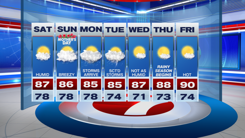
Unlike last weekend when it was rather cloudy with scattered showers and storms across the area, we will see a bit more sunshine in addition to mostly dry conditions this Mother’s Day weekend.
Expect a blend of sun and clouds on Saturday, eventually giving way to mostly cloudy skies late in the day. The breeze will be a bit stronger, becoming gusty at times, out of the southeast, which will at least make the heat a bit more bearable. Highs will reach the mid to upper 80s with feels-like temperatures topping off at around 90F.

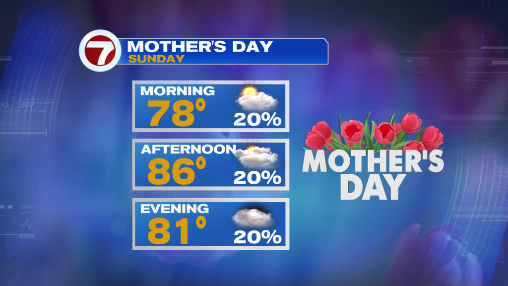
Sunday will be rather similar with the exception of there being more in the way of cloud cover. Perhaps a couple spotty showers could briefly move in. Overall, it will be a nice day to express your love to Mom!
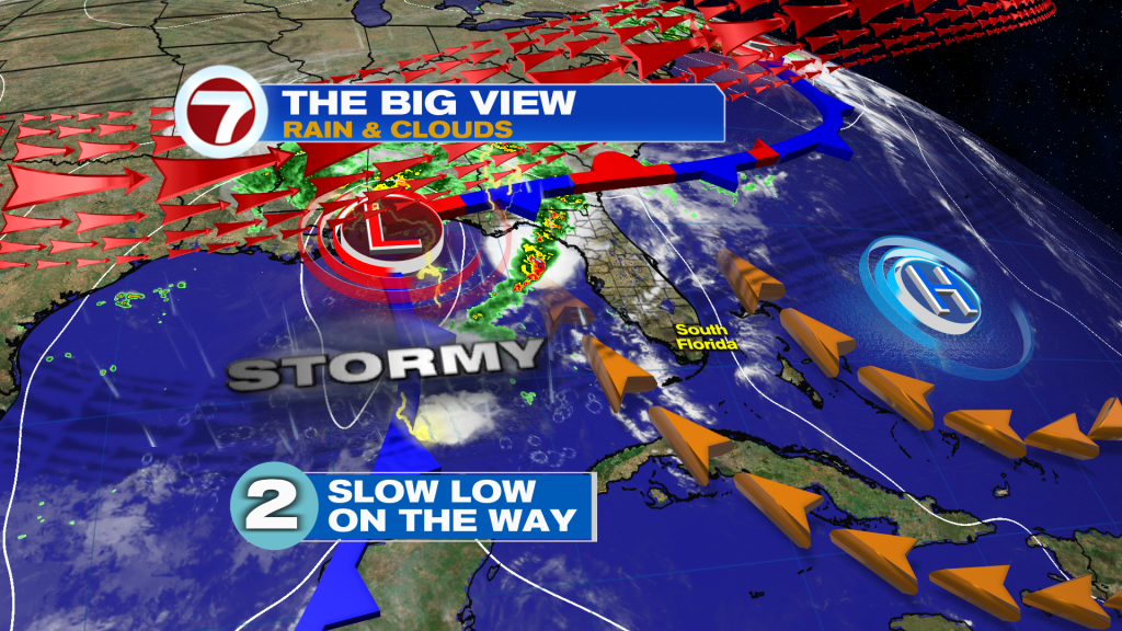
Conditions will gradually shift heading into the start of next week, however, as a front slowly moves in from the Gulf of Mexico. This is the same front that will be responsible for the increase in cloud cover this weekend due to storms off to our west.
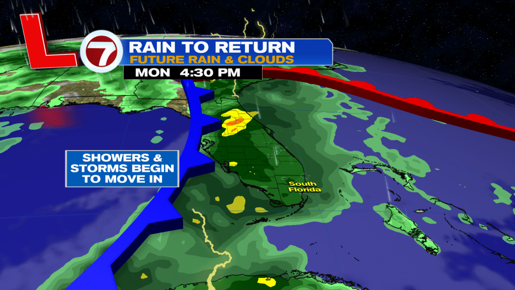
With the front getting closer on Monday, showers and storms will become increasingly likely. Therefore, expect rounds of rain and storms during the day Monday, especially during the second half.
That rain chance will remain high Monday night with additional storms still possible Tuesday as drier air gradually starts to flow in behind the front that moves through early Tuesday. It’s not until the end of Tuesday when it likely turns drier and the sunshine or clearer skies return.
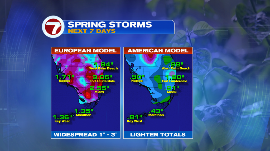
As far as rainfall is concerned, there are differences among the model guidance but many locations can expect to see at least an inch of rainfall with heavy totals expected.
Despite this front, it will actually turn hotter for the second half of next week with sunshine and dry conditions back in the forecast as rainy season starts Thursday.